
Archival research rarely starts with a fond number in hand. It starts with a small snag: an elongated pond drawn beside a stream on an old sheet, an abbreviation next to it, a road that changes direction — and then, on a later edition, nothing there at all. The commonest mistake is to write the story straight away: there was a mill here, and it was destroyed. So far the map has said one thing only: it carries a symbol that has to be decoded and checked.
What follows is a worked teaching case. The village, the dates and the features are invented to demonstrate the method; they do not describe a real place, a real fond or a real archival reply. The value is not in the plot but in the chain: observation → hypothesis → enquiry → document → careful conclusion.
This is step two of the series “From landscape to document”. Step one is relief, water and time on a historical map, where the question is only being formed. Step three is the find card and a personal context catalogue, where the answer finally gets filed. The basics of reading a sheet are in reading old maps.
A good research result is shorter and more cautious than a good legend. It shows exactly what a document confirms, and says plainly what is still a hypothesis.
The starting point: one small symbol on an old sheet
Our reader is looking at a plot near the fictional village of Novaya Sloboda. On a 1:100,000 sheet published in the early twentieth century there is a stream, an elongated pond, a road crossing the water, and the abbreviation мельн. (mill) beside a dam symbol. On a later sheet the pond is absent and the road runs slightly differently. Modern satellite imagery shows a field and a faint linear vegetation mark in the low ground.
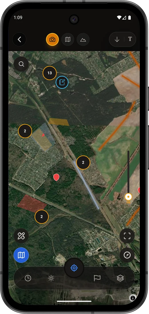
A topographic sheet, as USGS puts it, records natural and human-made features together — but it records them as a symbol, not as an explanation. The abbreviation itself still has to be checked against the legend of that particular series: see labels, abbreviations and lettering.
Here are two versions of the first notebook entry. One manufactures false confidence; the other starts the research properly.
| Wrong entry | Correct opening entry |
|---|---|
| “At the old mill near Novaya Sloboda, destroyed after the war” | “On the sheet [series, sheet, year] near Novaya Sloboda a pond, a dam and the label мельн. are shown; on the sheet [series, year] the feature is absent. The cause and date of the change are unknown” |
The correct entry already holds everything needed later: source, observation, comparison and the boundary of what you know. It does not answer the question — but it does not get in the way of an answer either.
What is known and what is only assumed
The first working document in this case is not the letter to the archive — it is an evidence table. It separates what is genuinely visible on the sheet from the explanations we have added to it.
| Level | Statement | Status |
|---|---|---|
| Observation 1 | On sheet A there is the label мельн., a pond and a dam symbol beside the stream | Confirmed by source A |
| Observation 2 | On the later sheet B the pond is not shown and the road has a different configuration | Confirmed by source B |
| Observation 3 | Modern imagery shows low ground and a linear vegetation mark, but does not confirm the function of the feature | Confirmed by a modern visual source, within limits |
| Hypothesis 1 | At the time sheet A was made there was a mill or another hydraulic structure near Novaya Sloboda | Reasonable hypothesis; needs documentary confirmation |
| Hypothesis 2 | The feature disappeared after a certain date | Not confirmed; a tighter chronology is needed |
| Unverified claim | “The feature was destroyed during the war” | Do not use without a source |
The difference between the rows is not stylistic. An observation can be shown to another person and they will see the same thing. A hypothesis is already an explanation, and it needs a source — otherwise it quietly migrates into the “known facts” column.
The map passport for this case
| Field | Entry |
|---|---|
| Source A | Series, sheet number, scale, year, link to the full scan |
| Source B | Series, sheet number, scale, year, link to the full scan |
| Feature | Pond, dam, label мельн. — with no automatic conclusion about the type of mechanism |
| Territory | Modern district or region, plus the historical administrative unit for period A |
| Legend check | Abbreviation verified against the legend or a reference work for this series |
| Overlay accuracy | Medium: fit checked on several landmarks; both the channel and the road have moved |
The “overlay accuracy” row is not paperwork. While the fit between the old and the new layer rests on a single landmark, it is a pretty picture rather than a georeference; the checks to run before a trip are collected in the overlay without self-deception. If the sheet belongs to a Soviet series, check the survey year and the printing year separately — see Red Army (RKKA) and General Staff sheets.
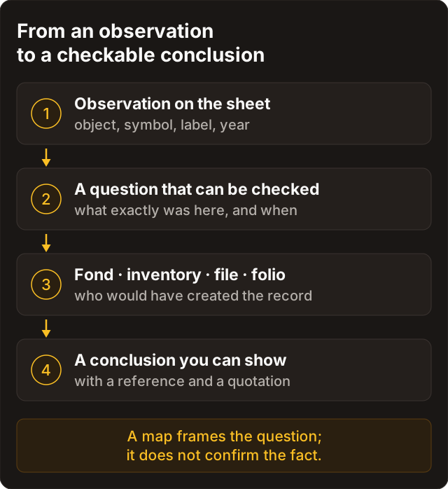
Turning the observation into an archival question
“What was here?” is too broad and almost unanswerable: an archive does not store answers, it stores documents that somebody once created for an administrative reason. So the question has to be rebuilt around records produced by a specific owner, agency or local authority.
| Observation on the map | Likely creator of records | Precise question |
|---|---|---|
| Pond and dam | Landowner, estate management, engineering or local self-government body, local administration | “Do you hold plans, registers or correspondence concerning the dam, pond or mill near Novaya Sloboda for 1890–1925?” |
| Realigned road | Roads or local self-government body, local administration | “Are there road plans, records of a relocated crossing or of bridge repairs near Novaya Sloboda?” |
| Feature missing between editions | Landholding organisation, local executive body, economic enterprise | “Are there acts of demolition, reconstruction, drainage or transfer of the feature for the years in question?” |
| Modern low ground and linear vegetation | Land drainage or hydraulic engineering organisation, project archive | “Do you hold material on drainage, ditches or regulation of the stream in this locality?” |
The question must not argue for your version. The phrasing “dam, pond or mill” keeps it open: the archive may confirm a different kind of feature, or point to a different fond — and that is a normal result, not a failure.
Choosing the institution and drafting the letter
The choice starts not with the most famous institution but with the territory and the type of record you expect. For local plans, registers and administrative correspondence, check the regional or municipal archive first. For central agencies — where their link to the feature is justified — the federal archive. For maps and rare reference works, a library or its map department. For object and expedition history, a museum or its research archive.
The full selection logic, the official contacts in Russia and Belarus and the letter templates are gathered in “The archive does not answer ‘what have you got’”. Before writing, look into the catalogue of guides to the federal archives of Russia and the fond catalogue of the state archives of Belarus: neither is an address for an enquiry, but both let you name a probable fond — or at least a direction — in your letter.
The sample letter
Subject: thematic enquiry — pond, dam and possible mill near Novaya Sloboda, 1890–1925.
Dear colleagues at [name of institution],
I should be grateful to know whether your holdings contain documents relating to a pond, dam, mill or other hydraulic structure near the village of Novaya Sloboda [modern district and region; historical administrative unit if known] for the period 1890–1925.
Purpose of the enquiry: to establish the nature of a feature shown on a topographic map and the chronology of its existence and alteration.
What is already known:
- on the map [series, sheet, year, scale] a pond, a dam and the label
мельн.are shown beside a stream; - on the map [series, sheet, year, scale] the pond is not shown;
- I am interested in plans, registers, correspondence, acts of repair or demolition, and material on drainage or regulation of the watercourse;
- a small sketch is attached, with the map source cited and without publishing sensitive coordinates.
If these documents are not part of your holdings, I should be grateful for any indication of the archive or type of fond where they might be sought. Please also advise on the procedure and cost of digital copies if material is available.
Yours sincerely, [name, e-mail].
The letter contains no assumptions about the war, destruction, “treasure”, archaeology or a right of access. It describes an observation and asks for specific record types — which is a letter a member of staff can actually answer.
Three possible replies and what to do next
Scenario A. The archive found the exact file
Suppose the reply reads: “File identified: fond N, inventory N, file N — ‘Correspondence on the repair of the dam at the mill of the village of Novaya Sloboda’, 1911.”
| What is now known | What is still unknown |
|---|---|
| In 1911 a mill and a dam existed and were the subject of correspondence | The construction date, the exact structure, what happened after 1911 |
| The file relates to the right territory and the right feature | Whether the feature still stood at the date of the later sheet |
| There is a reference code for ordering copies or a reading-room visit | How much of the information is actually on the folios of the file |
The next step is to order copies or read the file in the reading room, then cite it precisely: fond, inventory, file, folio and the literal wording of the relevant passage. A summary from memory a month later turns straight back into the legend we were trying to leave behind.
Scenario B. The archive gives a direction, not a document
The reply: “No information identified in our holdings; we suggest checking the fond of the local self-government board, the archive of the neighbouring region, or the archive of technical documentation.”
This is not a failure. The archive has done something valuable — it has narrowed the route. The notebook records not “nothing exists”, but “institution X identified nothing along the stated line; fond or archive Y recommended”. The next letter is adapted to the new addressee and states the checks already made, so staff are not sent round the same circle.
Scenario C. A different feature is confirmed
The archival record may turn out to concern not a mill but, say, a pond for estate water supply, a water intake, a fish-pond dam or a road repair. That is a good scholarly result: the hypothesis has been corrected by a document rather than bent to fit one.
| Old hypothesis | Documentary result | New conclusion |
|---|---|---|
| “Probably a mill” | The file names a pond for water supply | The map shows a hydraulic structure; a milling function is not confirmed |
| “The bridge went in the war” | The plan records a road realignment in the 1930s | The change belongs to road reconstruction; the reason the old symbol vanished is now clearer |
| “The old channel is natural” | The project file names a drainage ditch | The linear feature is artificial in origin |
Turning a document into a conclusion
An archival document is not a magic seal over the whole story. It confirms only what can honestly be drawn from its text, date, authorship and context. After that the work is editorial: writing your own sentence without letting it outgrow the source.
| Wording | Assessment |
|---|---|
| “A file of 1911 mentions repair of the dam at the mill of the village of Novaya Sloboda” | Correct, if that genuinely follows from the text of the file |
| “A mill existed no later than 1911” | A permissible inference from a documentary mention |
| “The mill was built in 1911” | Not permissible if the document speaks only of repair |
| “It disappeared after the war” | Not permissible without a source for the date and the cause |
| “Map and file agree: the sheet shows the feature and the file confirms it was working in 1911” | A correct synthesis of two sources with the limits stated |
The best outcome of this case reads like this: the topographic sheet shows a pond, a dam and the label “мельн.”; a file of 1911 confirms repair of a dam at a mill in this locality; the construction date and the later fate of the feature require separate sources.
Such a conclusion is no less interesting than the legend. It is stronger — because it can be checked, extended and quoted.
A document about the past grants nothing in the present. A feature confirmed by an archive is still a point on somebody else's land and may carry heritage protection: the legal regime is checked separately — see metal detecting and the law, which describes the Russian and Belarusian rules for readers searching there. At any sign of an archaeological layer, a burial or ordnance, work stops on the spot and the information goes through the local official procedure; why this is the amateur's boundary is set out in the test pit and where to stop.
The case card in Discovera
A case does not live in your head or in an e-mail thread; it lives in one record where the map, the question, the reply and the conclusion sit next to each other. The structure is the same as for the find card: observation in one field, source in another, conclusion in a third.
| Field | Entry in the teaching case |
|---|---|
| Base map | Sheet A: series, year, scale, link to the scan |
| Observation | Pond, dam, label мельн. |
| Hypothesis | Mill or other hydraulic structure; the function needs checking |
| Archival question | Plans, registers, correspondence on the dam, pond, mill, drainage |
| Addressee | Name of institution and the official enquiry channel |
| Reply | Date, the substantive quotation, reference code or recommendation |
| Document | Fond, inventory, file, folio, link or copy, conditions of use |
| Conclusion | Only what the sources confirm |
| Confidence | High, medium or low — with the reason why |
A checklist for your own research
| Before the letter | After the reply |
|---|---|
| Full scan of the sheet saved with its map passport | Reply saved with date and subject line |
| Legend and abbreviation checked against the series | Type of reply recorded: file found, direction, refusal or paid service |
| Observation separated from hypothesis | Reference code written out in full, no shortcuts from memory |
| Territory and period stated | Copying and citation conditions recorded |
| Question framed around a record type | Conclusion no stronger than the text of the document |
| Official addressee chosen by competence | A new question raised only where a gap remains |
See also
- The archive does not answer “what have you got” — the full route through the archives of Russia and Belarus.
- Relief, water and time — how a landscape on a sheet becomes a testable question.
- The overlay without self-deception — how not to mistake an approximate fit for proof.
- The find card and a personal context catalogue — where to keep sources, photos and decisions.
FAQ
Do I need to find the exact fond first?
Ideally yes, but it is not required. It is enough to narrow the enquiry to a territory, a period, a record type and a probable creator. An archive can point to a fond or a direction if the question is specific; there is simply nothing to answer to “what have you got on our village”.
The map and the document contradict each other. Which is right?
They may describe different moments, different aspects of the feature, or simply differ in accuracy. Do not pick the convenient source. Build a chronology, compare the survey and printing years of the sheet with the date of the document, and state the contradiction as a separate research question.
Can an archival reply prove that I may access the site today?
No. A documented fact about the past of a feature grants no right of access, work or intervention today. Ownership, heritage status and permits are checked separately and under current rules, not by a date in 1911.
If the archive asks for payment, should I simply decline?
You can ask for an itemised estimate: search, copies, delivery, publication rights. Sometimes it is enough to obtain the reference code and the description first, and order the copy later — or read the file yourself in the reading room.
How should a file be cited?
In full: archive, fond, inventory, file, folio — and separately what you took from it. Shortcuts from memory and a retold summary without a folio number make the citation unverifiable, and therefore useless to anyone who wants to continue the work.
Is it worth writing to several archives at once?
Better to move by competence: first the one most likely to hold the record, then the next, stating what has already been checked and where. A round-robin of identical letters saves your time and spends other people's, and the replies are hard to reconcile afterwards.
Sources
- Catalogue of guides to the federal archives of Russia
- State Archive of the Russian Federation (GARF) — contacts and enquiry procedure
- Russian State Historical Archive (RGIA) — reference information
- Fond catalogue of the state archives of the Republic of Belarus
- Department for Archives and Records Management of Belarus — contacts of the state archives
- National Historical Archives of Belarus — contacts
- U.S. Geological Survey — Topographic Mapping