Discovera · Free browser tools

Tools for old maps and .sqlitedb tiles

Two small inventions we built to make the Discovera field workflow smoother — and shipped as standalone web tools so anyone can use them without installing the app. Open a tool, pick your file, work in your browser. Nothing is uploaded to a server.

Tool 01 · Web

Discovera Georeferencer

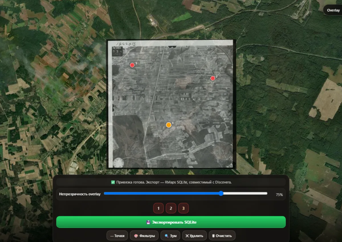
Align a scanned historical map with the modern satellite map by clicking control points, then export an RMaps-compatible .sqlitedb you can drop straight into the Discovera Android app as a custom overlay.

  • Place 3+ control points on both the old map and the satellite
  • Live opacity overlay, sharpen / contrast / brightness filters
  • Per-zoom tile estimate and one-click RMaps SQLite export

Tool 02 · Web

Discovera Map Preview Extractor

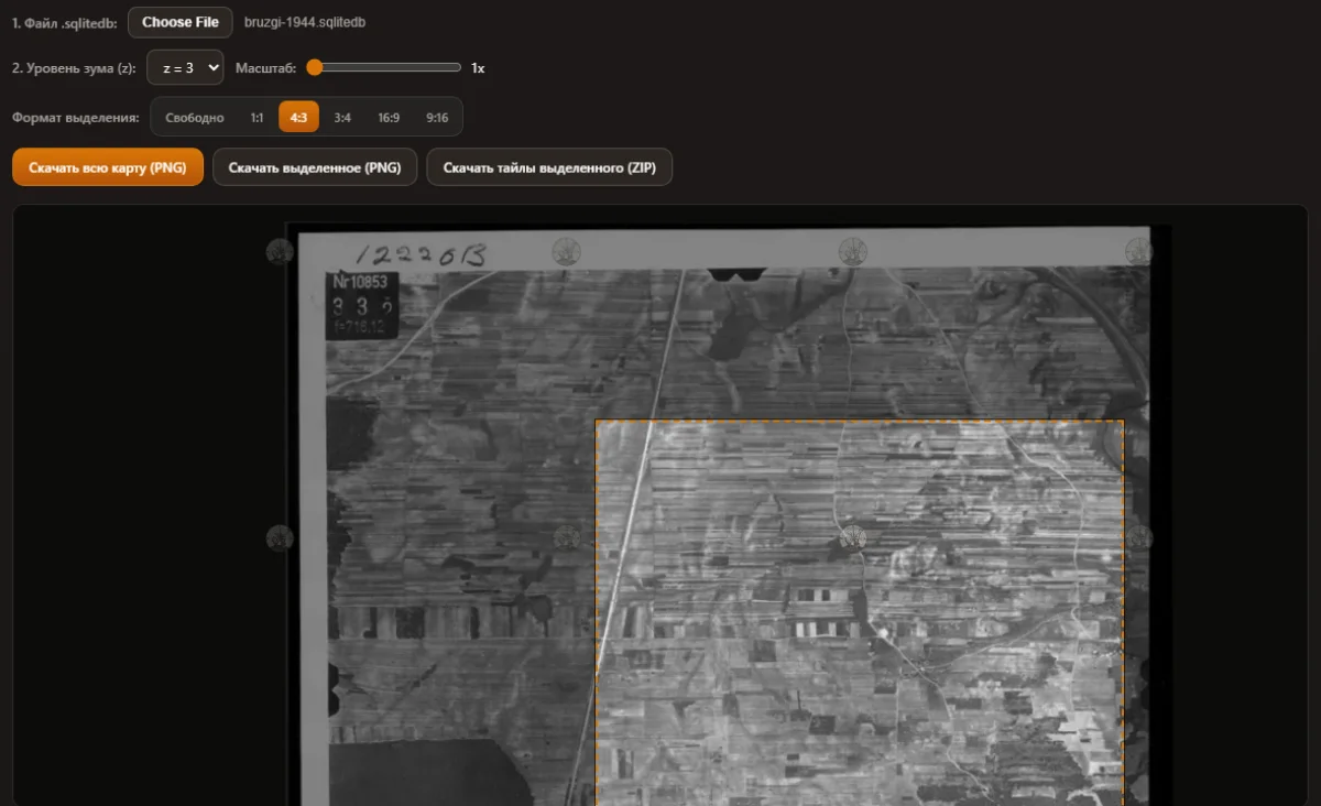
Open a Locus / RMaps style .sqlitedb tile database, preview any zoom level, pick a rectangular region and download it as a single PNG or as a ZIP of the original PNG tiles. Useful for sharing screenshots, building atlases or feeding tiles to other tools.

  • Works with tiles(x,y,z,image) SQLite layouts
  • Aspect-ratio presets (1:1, 4:3, 16:9, …) for clean crops
  • Export full map PNG, region PNG, or ZIP of original tiles

FAQ

Common questions

Do these tools upload my maps anywhere?

No. Both tools run entirely in your browser — your .sqlitedb files and scans never leave your device.

Which file formats are supported?

The Georeferencer accepts PNG, JPG and WebP scans up to roughly 30 MB and exports an RMaps-style .sqlitedb. The Preview Extractor reads SQLite tile databases with a tiles(x, y, z, image) schema (Locus Map / RMaps / Discovera).

How do I use the resulting .sqlitedb inside Discovera?

Open Discovera on Android, go to map settings → historical maps → import, and pick the file. The Georeferencer writes the schema Discovera expects so the import is one tap.

Are the tools free?

Yes — both tools are free to use, with no sign-up. The companion app is also free on Google Play.