 Google Play
Let's start with what this comparison won't contain: a magic ranking, and an app that shows you where to dig. The second doesn't exist, and the first is useless, because the "best" app depends entirely on what you actually do in the field.
Every good app has the same job: turn an outing into a coherent story rather than thirty screenshots in your gallery with no connection between them a month later. Here's what that job breaks down into.
Four kinds of app
Focused mapping apps. Strong on historical base layers and overlays, and they stop there. No finds catalogue, no community, no photo analysis. Vetus Maps is a typical example of the category.
General GPS navigators. Powerful offline support, flexible layers, everything for tracks — Locus Map being the classic. An excellent map in your pocket, but the finds journal and field diary have to be assembled by hand out of whatever's available.
Coin catalogues. Useful for organising and valuing finds. Maps and routes aren't their business, and that's fine.
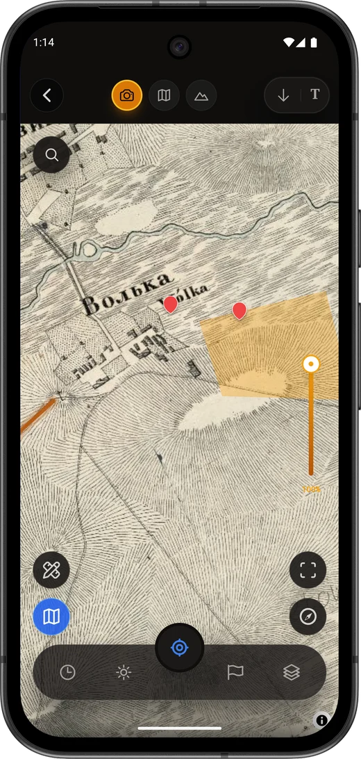
All-in-one. Maps, offline, catalogue, community and prompts in one place. Discovera for Android sits here: historical base layers, a public map archive, a catalogue with AI analysis, a mentor chat, rallies and a feed.
What to check before you commit
For maps and overlays the checklist lives in old maps on your phone, including layer opacity, offline and georeferencing. What matters here are the broader criteria.
Android or iPhone. Most field workflows are stronger on Android: offline map files, .sqlitedb import, flexible layers. Discovera is Android-only right now, and if you're on an iPhone it's more honest to point you straight at the dedicated iOS mapping apps.
Region. Local historical sources and local law matter enormously. An app that works beautifully in Britain may be useless over an imperial Russian survey sheet.
Do you need coin valuation. If all you want is a price and a catalogue, a reference app is enough. If you want to connect place, history and object, you need a map and a journal.
Offline. Check it before you leave. Discovering that the offline area didn't finish downloading, in the middle of a field with no signal, is a rite of passage nobody enjoys.
When one app beats four
If your outing looks like "plan a route on a historical layer, work with no signal, save a find with its context, analyse the photo and cross-check the map archive", then keeping that across four services gets tiring fast.
If you just want to occasionally see what stood here in 1860, a focused mapping app will do it, and there's nothing to pay extra for.
FAQ
Which detecting app is best?
The one that covers your scenario. Mapping apps for maps, reference apps for coin catalogues, Discovera for the full field cycle on Android. There is no universal answer, and any review that gives you one is selling something.
Do I need several apps at once?
Often yes: a navigator plus a coin reference is the commonest pairing. The point of an all-in-one is to shrink that collection, if Android works for you.
Can I search for archaeological sites "using an app"?
No. Detecting on heritage sites and removing archaeological objects without authorisation are illegal, and no app changes that. Apps are for documentation, learning and lawful scenarios.
Where do I download Discovera?
On Google Play: Discovera. The app is out in open testing: it installs as usual and works in full while we polish the last details.
Bottom line
There are really four criteria: a historical overlay, offline coverage, a journal that keeps context, and an understanding of the law. Everything else comes down to how many apps you're willing to keep open at once.