 Google Play
People talk about coils far more than about how to actually walk a site. Yet the difference between "crossed the field" and "worked the field" adds more finds than any hardware change.
Tactics start with understanding where you're standing. Woodland, beach and a former homestead want different pace, different coils and a different attitude to signals. Here they are in turn.
Woodland
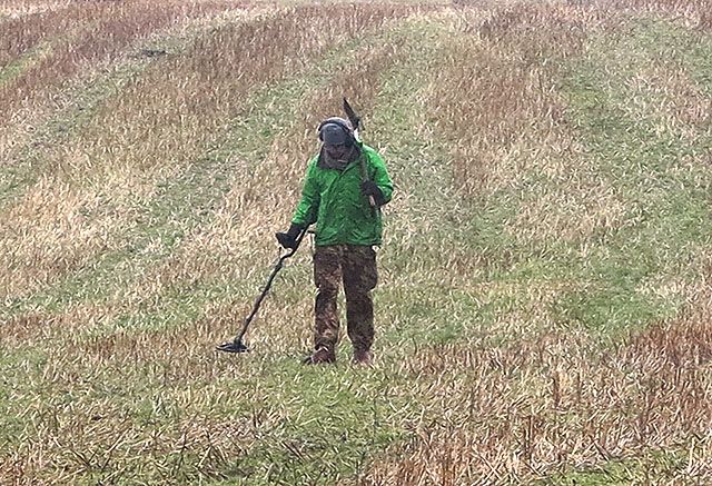
In woods the layer is usually calmer than on ploughed land — nothing has turned it over every year. Work the paths, the edges and the ground around noticeable old trees: those were landmarks for the people who walked here before you.
A sniper coil earns its keep among roots. And on landmarks: mark them immediately. "That particular tree" looks exactly like the hundred beside it a year later, and an hour of wandering is guaranteed.
A path isn't a monument in itself, but that doesn't settle the land status — check before you go.
Beach
The best time is after a storm, and early, before the churned sand has been walked over. Beach detecting is the one scenario where you read the forecast hoping for the worst.
Dig the doubtful non-ferrous signal: gold on a beach sounds quiet and unremarkable, which is exactly why people pass it. Salt needs stable ground — there's a dedicated section in choosing a detector.
Tides and restricted zones aren't details, they're planning. Low water gives you a zone that won't exist in four hours.
Field and homestead
Pottery and brick fragments tell you people lived here. Don't chase the non-ferrous signals straight away — the density of domestic debris shows where the buildings stood, and that's worth more than one stray coin.
Ploughing drags a complex across the field, so look for concentration rather than a spot: the yard on an old map plus the density of domestic finds. More in hoard types.
A hole is a neat square with the turf put back, not a bore hole. And log the empty squares too, or you'll walk them again and again.
The grid
- Break the area into strips or squares on the map.
- Mark both the empty and the productive parts.
- Don't abandon a square after the first signal — listen for what's next to it.
- A pinpointer saves both time and the small finds that otherwise go into the spoil.
- With a partner, agree in advance: one grid plan, and who fills the holes.
Pace beats depth
The classic second-month mistake is speeding up. More ground covered feels like better odds. In practice a fast sweep breaks signal repeatability and you start digging phantoms instead of targets — covering more ground and finding less.
A slow strip with a readable tone produces more than a sprint across the whole field. And if the threshold drifts, stop, reset ground balance and sensitivity, then return to the grid. You cannot compensate for bad settings with more holes.
The map answers where, the law answers whether
Two different questions, and confusing them is expensive. The map shows where daily life made sense: a yard, a road, a mill. The law decides whether you may be there with a detector at all.
Both need checking, before you leave: legal status, regional rules, beginner mistakes.
Before you go
- Scenario clear, map ready.
- Grid agreed with your partner.
- Settings stable for this ground.
- Pins from the first signal onward.
- Holes filled. All of them.
FAQ
How do I start a grid?
With a polygon on the map, then strips or squares, then "empty / signal / find" pins. Holes dug on inspiration don't add up to statistics.
Woods, beach, homestead — same tactics?
No. Woods means landmarks and a small coil, beach means churn and salt, a homestead means the domestic layer and the yard on an old map. Each is broken down in the sections above.
Why does a pinpointer matter tactically?
It shrinks both the hole and the time spent at it, which means more ground covered per outing. See equipment.
What if the threshold drifts?
Stop the grid, reset ground balance and sensitivity, go back to the strip. Don't try to make it up with volume.
How do tactics connect to the law?
Land status first (legal status), grid second. A good overlay is not a permission.
Do I need a partner for a grid?
Not required, but there's less chaos with one: a shared polygon and an agreement on who fills the holes. Keep your own pins regardless.