On an old map a line is rarely just a line. The same thin stroke can be a post road, a field track, a footpath, an estate boundary, a forestry ride, a ditch, a stream, a railway, an earthwork bank, or a late editorial overprint. Getting it wrong is easy: the eye likes to continue a familiar shape and build a route where the surveyor drew something else entirely.
This is step two of the series “The language of the old map”. Step one — topographic map symbols — covers the alphabet: points, areas, colours, lettering. This article is about the syntax: how a line, its junctions and the relief add up to a claim about movement, and where that claim stops.
Linear symbols are never read from one feature alone. The meaning comes from the drawing of the line, its colour, its label, its junctions, the relief, the scale, the date and the legend of that particular series. The USGS sets out the basic principle: symbols show features as points, lines or areas depending on their size and extent. But exactly how a route, a watercourse or a boundary looks depends on the cartographic school and the period.
A map records how a feature was described at the moment of survey. It does not prove that the line survives on the ground, that it is passable, that access is open, or that it means the same thing today.
Why lines mislead more often than points
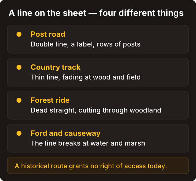
A point symbol usually stands for one identifiable thing — a church, a mill, a station, a single building. A line runs for kilometres and changes character along the way. In one stretch it is thin, in another doubled, in a third it carries a label or hachures. You cannot settle its meaning from its shape on a phone screen.
| What changes the meaning of a line | The question to ask |
|---|---|
| Colour and weight | Is this water, a road, a boundary, a relief stroke, or an editorial correction? |
| Continuity | Does the line really carry on, does it die at the sheet edge, break in woodland, or change category? |
| Junctions | What happens where it meets a river, a railway, a boundary, another road? |
| Labelling | Is there a name, an abbreviation, a road number, a feature designation, or an owner or parcel note? |
| Relief | Does the line follow the logic of a descent, a bridge, a saddle, an embankment or a channel? |
| Scale and date | Can this map even separate road, path and forestry ride; was the feature already obsolete at publication? |
The most useful habit here is to stop asking “what is this line?” and start asking: “which three features confirm that this is a road?” If there is no confirmation, what belongs in the journal is not a confident reading but a hypothesis with a stated confidence level.
What the map does not prove
Most mistakes with linear features are not recognition errors. They are substitutions: the symbol was read correctly, and then a conclusion was drawn that the symbol never contained. It helps to keep a short list of what a map specifically does not prove.
| It looks as if the map proved this | What it actually recorded |
|---|---|
| There was a road here, so there is one | That at the date of survey the compiler chose to show a linear feature of that category |
| There is a bridge, so there is a crossing | That an organised crossing existed at survey time, not necessarily in the same spot or the same form |
| The line runs to a village, so the village is inhabited | That the settlement existed in the form the surveyor recorded and generalised |
| A road is shown, so the place is open | Nothing at all about right of way, ownership, protected status or land designation |
| Two maps show the same thing, so it is confirmed | Possibly the second sheet was compiled from the first rather than surveyed afresh |
| The line looks old, so it is historical | Possibly it is an editorial element: a neat line, a grid, a join, an overprint, a georeferencing trace |
Hence a simple rule: a map is evidence about a state of affairs on a date. It answers neither “what is there today” nor “what may be done there”. The second question is settled separately, and before you travel — see legal status.
Seven kinds of linear feature
Names and symbols differ between series, but it helps to sort a line into a broad family first and only then go to the legend of the specific sheet.
| Family | What it can include | What to look at |
|---|---|---|
| Routes | Post road, metalled road, unmetalled track, country lane, footpath, street, railway | Width, doubled outline, labelling, bridges, junctions, links to settlements |
| Water | River, stream, ditch, canal, seasonal watercourse | Colour, direction toward a water body, sinuosity, labels, marsh and bridges |
| Boundaries | Administrative, estate, forestry, parish, state | Tick marks, symbols set along the line, labels, links to compartments and boundary markers |
| Forestry and estate lines | Ride, compartment edge, drain, baulk, fence, planting line | Rhythm, straightness, grid pattern, ties to woodland or fields |
| Engineered features | Embankment, cutting, dam, telegraph line, pipeline, power line on later maps | Tick symbols, paired outlines, labels and the character of junctions |
| Relief forms | Gully, ridge, scarp, bank, terrace edge | Hachures, contours, shading, spot heights, and the absence of transport links |
| Editorial elements | Grid, sheet boundaries, overprints, later corrections, georeferencing lines | Neat line, print colour, typeface, and no relationship to the ground |
The family is not an answer; it narrows the search. The answer comes from the legend of the edition: the National Library of Scotland keeps Ordnance Survey characteristic sheets separately by scale and period precisely because the graphic language of a map only makes sense inside its own series. Labels, abbreviations and lettering are a layer of their own — see map labels and abbreviations.
Observation — hypothesis — check
A route rarely exists on its own. It joins things, changes character at a settlement, crosses water at a structure, and picks the easier landform. A watercourse, by contrast, obeys the relief; a boundary tends to follow administrative or tenurial logic; a forestry ride usually sits inside a compartment grid.
| Observation on the sheet | Hypothesis | How to check it |
|---|---|---|
| The line runs to a settlement, bridge, station or crossing and continues beyond it | A route | Legend, adjacent sheet, a larger-scale edition, modern orthophotos |
| The line winds along low ground, gathers tributaries and enters a water body | A watercourse | Colour, hydrographic symbols, direction of fall, labels |
| The line is almost straight and forms a regular grid inside woodland | A forestry ride or compartment edge | Woodland context, parallel lines, compartment numbering |
| The line follows field edges or an administrative outline, often dashed | A boundary or baulk | Legend, labels, cadastral or administrative layer |
| The line carries distinctive junction symbols and a made formation | A railway or engineered feature | Legend, stations, level crossings, embankments and cuttings |
| The line breaks on slopes and sits next to relief hachures | A gully, scarp or other relief form | Contours, spot heights, the shape of the catchment |
No single feature works in isolation. A straight line can be a road or a ride; a winding one can be a path or a stream. Confidence appears only once the hypothesis has been tested against an independent source.
The most accessible independent source for linear features is imagery from above. Wartime aerial photography of 1939–1945 from the NARA holdings is collected on the Discovera aerial imagery page: it shows the ground before post-war field amalgamation and drainage schemes, and often answers whether a feature was physically on the ground at all, rather than only on paper.
Crossings: bridge, ford, dam and ferry
A water crossing is one of the most informative subjects on a map and one of the easiest to romanticise. A bridge, a ford, a dam and a weir are different kinds of infrastructure and may differ in age, accessibility and status. Some series give them their own symbols; others show only a break in the road, or a label.
| Feature | What it tells you about the map | What it does not tell you |
|---|---|---|
| Bridge | At survey time an organised crossing existed; route and water were joined by a built structure | That the bridge survives, is accessible, or stands in the same spot today |
| Ford | The surveyor marked a possible crossing of the watercourse without a permanent bridge | That the crossing is safe or legally permissible now |
| Dam or weir | Water and working infrastructure were linked; channel and level may since have changed | That the structure is sound or bears weight; such places must never be treated as a route |
| Ferry crossing | A link between the banks was organised, sometimes seasonally | That it ran continuously or left a visible trace in the modern landscape |
Reading a crossing correctly depends on its surroundings: the road up to it, the continuation on the far bank, the label, the nearest settlement, a mill, a railway, a change in relief. But historical information is not an invitation to visit or survey the site. Banks, bridges and water structures change condition, and access to them is regulated separately.
Water infrastructure is not a route. Dams, weirs, sluices and their approaches change condition, are usually in someone's care, and can be dangerous regardless of what a 19th-century sheet shows.
Relief and water as an independent check
Relief rarely draws a road for you, but it tests a hypothesis well. A route usually seeks a sensible way across a slope, an easier way round an obstacle, or a convenient landform. A watercourse, on the contrary, obeys the direction of fall. This is not a mechanical rule: historical roads sometimes ran awkwardly by modern standards, and the surveyor may have generalised the line. But relief is a useful second, independent voice.
| If the line… | Ask yourself |
|---|---|
| Crosses the contours | Is this a climb or a descent, a road on a slope, or a feature unrelated to movement? |
| Runs along a valley | Could this be water, a valley road, a boundary, or several features side by side? |
| Approaches a sharp scarp | Is there a bridge, a zigzag, a cutting, a label or any other sign of an engineering solution? |
| Barely responds to relief and holds a straight course | Might it be a forestry ride, a grid line or a boundary? |
On old maps the relief may be shown not by modern contours but by hachures, wash or shading. So establish the cartographic tradition and the scale first, and only then draw a conclusion about the line. More on this in relief and water on historical maps.
A routine for testing the hypothesis
Instead of “I found an old road”, it is more useful to run a short routine. It turns an attractive line on a screen into a transparent working hypothesis.
| Step | What to do | What to record |
|---|---|---|
| 1 | Establish the series, year, scale and sheet number | The map's passport |
| 2 | Find the line in the legend or in the characteristic sheet for that series | The exact or presumed feature category |
| 3 | Trace it to two or three checkable features: a settlement, bridge, station, landform | The line's relationships on the map |
| 4 | Compare with the adjacent historical sheet and with a modern layer | What persists, what disappears, where the discrepancies are |
| 5 | Assess the relief and hydrography | Support for, or doubt about, the interpretation |
| 6 | Check the legal status of the area separately from the map | The basis for any lawful visit |
| 7 | Mark a confidence level: high, medium or low | An honest boundary around your conclusions |
Why the routine matters is clear from international practice. The USGS explicitly warns that symbols changed over time and that no single document covers every series and period. The same holds for the Shubert three-verst map, Red Army (RKKA) sheets, the German Messtischblatt and the Polish WIG series: each has its own vocabulary.
Step 4 is the bottleneck. An overlay of an old sheet on a modern layer is easy to nudge toward the answer you want, so check the georeferencing by the rules in overlay without self-deception; the general context on verst scales and 19th-century sheets is in reading old maps. Soviet series have their own quirks, covered in RKKA and General Staff maps.
Five questions to ask yourself
Before you write down “old road”, answer five questions. They take three minutes and remove most of the false confidence.
- Which series am I reading? Year, scale, edition, sheet number — and have I seen the legend of that edition, not a similar one.
- Which three independent features support the category? And do they really reduce to a single observation retold three ways.
- Where does the line go and how does it end? Does it join checkable features, or simply die at the sheet edge.
- What do relief, hydrography and the adjacent sheet say? Do they confirm, stay silent, or disagree.
- Have I separated “does it survive” from “may I go there”? These are two different questions, and the second is not answered by a map.
If the answer to even one of them is “I don't know”, the confidence level is low. That is a normal working result, not a defeat: an honestly recorded low confidence costs far less than a high confidence built on a single stroke.
What to record in the Discovera journal
A line on a map can be a strong hypothesis, but only if a month later it is still clear why you decided it means a road, a ford or a forestry ride.
| Field | Example of a sound entry |
|---|---|
| Source | “Messtischblatt, sheet…, year…, scale…” |
| Observation | “A thin line runs between two settlements and crosses water at a point with its own symbol” |
| Hypothesis | “Probably a road with a bridge; needs checking against the legend and the adjacent sheet” |
| Check | “Modern relief confirms the valley; imagery from above shows a linear band, but access and status were not assessed” |
| Confidence | “Medium: supported by two features, no legend for this specific edition” |
An entry like that is more useful than the label “old road”. It preserves your reasoning, lets you correct a mistake, and does not manufacture false certainty for your own benefit six months later.
Maps, law and going out
Reading lines is desk work. It answers the question “what was shown here”, and no other question at all.
A map grants no permission. Historical interest in a route does not override protected designations, the landowner's rights or the law; the status of the land is checked separately and before you travel.
The limit of intervention is worth stating separately. If signs of an archaeological layer, a burial or ordnance appear on the ground, work stops there: do not widen the intervention, record the position and follow the local procedure. How that works is in what to do when you find something; the legal frame is in legal status.
FAQ
Is every straight line in woodland an old road?
No. In woodland, straight regular lines are more often forestry rides, compartment edges or editorial elements of the sheet. Check the link to the road network, the legend of the edition, the adjacent sheets and modern sources.
If a road is visible on an old map, does it exist on the ground?
No. The road may have gone, shifted, been buried under modern infrastructure, or survive only as microrelief. A map records a state of affairs at the date of survey or publication, not today.
Can a bridge serve as a precise control point for an old overlay?
Sometimes, but carefully. Bridges get replaced, moved, rebuilt, and their approaches redesigned. Build the georeferencing on several independent stable landmarks and use the bridge as a check point rather than an anchor.
How do I tell a ford from a bridge?
Only from the legend of the series, the label and the cartographic context. A break in the road at a blue line is not enough on its own: it can mean a ford, a bridge below the generalisation threshold, or simply a simplified line.
Does a doubled line always mean a highway or post road?
No. Different series use a doubled outline for an improved road, an avenue, a canal, an embankment with a cutting, and a right-of-way strip. Pairing and weight indicate a category inside one legend; they are not a universal code.
The historical road looks interesting. Can I plan a search along it?
Only after checking the status of the land and the conditions of access separately. Historical interest in a route does not override protected designations, ownership or the law. Where the context looks complicated, intervention is stopped rather than widened.
Sources
- U.S. Geological Survey — Topographic Map Symbols
- U.S. Geological Survey — Where can I find a topographic map symbol sheet?
- National Library of Scotland — Ordnance Survey Characteristic Sheets
- National Library of Scotland — Map Images
- The National Archives — Maps and plans
- Archiwum Map Wojskowego Instytutu Geograficznego — WIG sheets